Stepper
Exploring a new city and its transit options can be a source of stress and anxiety, but it doesn’t have to be. New York City is a magnet for visitors, with over 60M newcomers arriving each year; addressing the challenges they face in adjusting to urban life is crucial. Everyone in this vibrant metropolis deserves to feel safe, confident, and empowered when using public transit. Newcomers to NYC deserve a seamless and anxiety-free commuting experience when navigating the city.
Stepper, a user-friendly mobile app, emerged from the frustration and anxiety many newcomers face while navigating unfamiliar subway lines and stations.
Grounded in research highlighting NYC newcomers’ desire for reliable information, feelings of isolation, and being unsure of who or how to ask for help while navigating the city, Stepper aims to help. Real-time route updates help minimize personal delays and enhance learning and understanding. Additional augmented reality wayfinding provides clear directions overlaid on your screen while navigating underground tunnels, confusing connections, and hard-to-find exits.
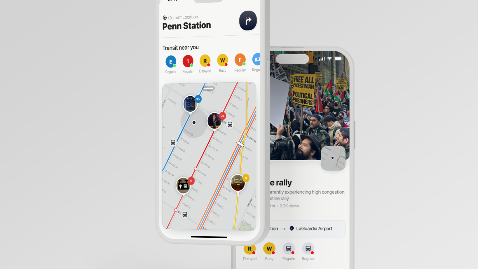
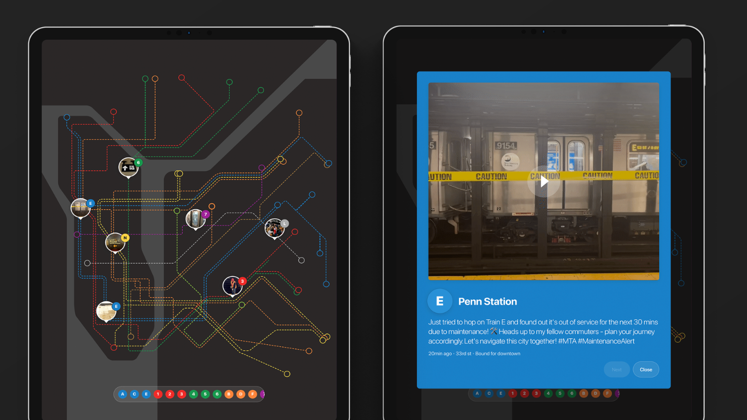
Beyond the app, Stepper provides an interactive real-time transit map aggregating live updates from other riders and reputable news sources. This comprehensive view of the transit landscape lets users stay informed about ongoing events, traffic incidents, and other factors affecting their route, reducing stress and uncertainty during their commute.
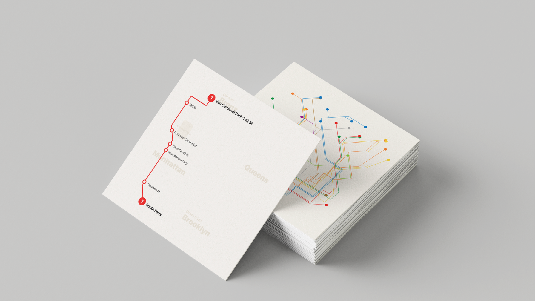
Lastly, Stepper includes a compact-sized backup paper map for scenarios where digital devices are unavailable. This hand-held resource ensures users can navigate the city confidently, even in situations with low batteries or limited access to technology.
By offering a user-friendly and culturally sensitive solution, Stepper aims to reduce anxiety and facilitate a seamless commuting experience for newcomers in New York City.